Home
ABOUT THE GIS CELL
GIS Cell is an interdisciplinary department of the institute which was established in the year 2006. MNNIT Allahabad has taken an early initiative in this field by establishing GIS Cell and is among few premier technical institutes of India to offer M.Tech. in Geoinformatics (erstwhile GIS and Remote Sensing) from academic session 2006-07. It offers M.Tech. (Geoinformatics) and PhD (GIS and Remote Sensing) programme. Additionally, GIS Cell conducts research in all major disciplines of Geospatial technologies namely Global Navigation Satellite System (GNSS); Geographic Information System (GIS); Satellite Image Processing; Advanced SAR Interferometry (InSAR); Airborne-, UAV-, and Ground-based Mobile LiDAR Technology, etc. The Cell is equipped with state-of-the-art laboratory facilities and a well-defined course structure and undertakes research in wide-range of research interests. GIS Cell also hosts Regional Center for Geodesy (RCG), a Department of Science and Technology’s center of excellence, to help spread Geodesy education in the country.
The evolution of Geoinformatics has been marked by significant advancements, beginning with traditional cartography and land surveying. Since the last two decades, Geoinformatics saw broader applications in urban planning, environmental monitoring and disaster management, driven by open-source GIS tools and the integration of big data analytics. Recent years have witnessed the transformation of Geoinformatics through cloud computing, artificial intelligence, machine learning and Internet of Things (IoT) enabling real-time data collection, sophisticated spatial analysis and enhanced 3D visualization. Today, Geoinformatics is essential in various sectors, including sustainable development and geospatial intelligence, with ongoing innovations promising even broader applications and advancements in the future.
Vision
To establish an identity in the area of Geoinformatics amongst national and international academic and research organisations through knowledge creation, acquisition and dissemination for the benefit of society and national development.
Mission
To provide quality education and interdisciplinary research leading to M. Tech. (Geoinformatics) and Ph.D. (GIS and Remote Sensing) degrees which produces globally acceptable skilled manpower. To generate and disseminate knowledge and technologies essential to the local and global needs in the field of Geoinformatics.
Academic Programme
M.TECH. (Geoinformatics) AND Ph.D. PROGRAMME (GIS & Remote Sensing)
Eligibility for M.Tech. Programme: M.Tech. (Geoinformatics)
Bachelor's degree with minor / honours or equivalent in the appropriate branch of Engineering /Technology OR Master Degree in the appropriate discipline of Science
Eligible GATE Papers: Agricultural Engineering (AG), Architecture and Planning (AR), Civil Engineering (CE), Computer Science and Information Technology (CS), Electronics and Communication Engineering (EC), Electrical Engineering (EE), Geology and Geophysics (GG), Mining Engineering (MN), Geomatics Engineering (GE), Data Science & Artificial Intelligence (DA), Mathematics (MA)
Eligibility for Ph.D. Programme (GIS & Remote Sensing)
- M.Tech. or equivalent degree in GIS & Remote Sensing or equivalent discipline/Civil Engineering/ Computer Science and Engineering /Electronics Engineering /Electrical Engineering / Mechanical Engineering /Information Technology /Agriculture Engineering /Mining Engineering; with minimum marks 60% or CPI 6.5 (In case of SC/ST/PwD marks not below 55% or CPI 6.0).
- or M.Sc. or equivalent degree in GIS & Remote Sensing/Applied Geology/ Geophysics/Geography/ Environmental Science/Computer Science/Mathematics with minimum marks 70% or CPI 7.5 (In case of SC/ST/PwD marks not below 65% or CPI 7.0).
- or Degree in Master of Computer Application with minimum marks 70% or CPI 7.5 (In case of SC/ST/PwD marks not below 65% or CPI 7.0).
- or Bachelor’s degree in Engineering with a minimum of 70% marks or CPI 7.5 (In case of SC/ST/PwD marks not below 65% or CPI 7.0)
(Candidates meeting above mentioned eligibility criteria must have Mathematics as subject up to 10+2 level)
Note: The eligibility criteria are subject to change as per the latest admission information brochure.
PROGRAM SPECIFIC OUT COMES (PSOs)
- PO1 – Geospatial Knowledge: Demonstrate a strong understanding of GIS, remote sensing, GPS, and spatial data management principles.
- PO2 – Technical Skills: Develop proficiency in GIS software, spatial databases, digital mapping, and geospatial analysis techniques.
- PO3 – Problem Solving: Apply GIS tools and spatial analysis to address real-world challenges in urban planning, agriculture, disaster management, environmental monitoring, and resource management.
- PO4 – Data Management: Collect, process, analyze, and visualize geospatial data accurately while maintaining data quality and integrity.
- PO5 – Research and Innovation: Promote research, innovation, and the adoption of emerging geospatial technologies for sustainable development.
- PO6 – Teamwork and Communication: Collaborate effectively in multidisciplinary teams and communicate geospatial findings through maps, reports, and presentations.
- PO7 – Ethical and Professional Responsibility: Follow ethical standards, and professional practices in the use and sharing of geospatial data.
- PO8 – Lifelong Learning: Engage in continuous learning to keep pace with advances in GIS, remote sensing, artificial intelligence, and geospatial technologies.
- PO9 – Community and Environmental Impact: Use geospatial technologies to support evidence-based decision-making, environmental conservation, and community development.
- PO10 – Employability and Entrepreneurship: Build professional competencies that enhance career opportunities and encourage innovation and entrepreneurship in the geospatial sector.
Program Educational Objectives (PEOs)
- PEO 1 – Geospatial Competence: Develop a strong foundation in GIS, Remote Sensing, GPS, and spatial data analysis to solve real-world problems.
- PEO 2 – Professional Excellence: Apply geospatial technologies effectively in areas such as urban planning, environmental management, agriculture, disaster management, and natural resource conservation.
- PEO 3 – Research and Innovation: Promote research, innovation, and the adoption of emerging geospatial technologies to address societal and environmental challenges.
- PEO 4 – Ethics and Sustainability: Demonstrate ethical practices in the collection, management, analysis, and sharing of geospatial data while supporting sustainable development.
- PEO 5 – Leadership and Lifelong Learning: Develop leadership, teamwork, communication, and continuous learning skills to adapt to advances in geospatial science and technology and contribute effectively to academia, industry, and society.
Courses
Course structure (M.Tech. Programme (Geoinformatics))
Course Name: M.Tech (Geoinformatics) (Full – Time)
First Semester
| S.No. | Proposed Course No. | Subject Name | Credits | L | T | P | TA | Mid | End |
| 1 | GI21101 | GIS Technology | 4 | 3 | 1 | | 20 | 20 | 60 |
| 2 | GI21201 | Geoinformatics Lab-I | 4 | 0 | 0 | 6 | 50 | 0 | 50 |
| 3 | | Elective I | 4 | 3 | 1 | | 20 | 20 | 60 |
| 4 | | Elective II | 4 | 3 | 1 | | 20 | 20 | 60 |
| 5 | | Elective III | 4 | 3 | 1 | | 20 | 20 | 60 |
| Total Credits | 20 | |
Second Semester
| S.No. | Proposed Course No. | Subject Name | Credits | L | T | P | TA | Mid | End |
| 1 | GI22101 | Satellite Image Processing | 4 | 3 | 1 | | 20 | 20 | 60 |
| 2 | GI22201 | Geoinformatics Lab-II | 4 | 0 | 0 | 6 | 50 | 0 | 50 |
| 3 | | Elective IV | 4 | 3 | 1 | | 20 | 20 | 60 |
| 4 | | Elective V | 4 | 3 | 1 | | 20 | 20 | 60 |
| 5 | | Elective VI | 4 | 3 | 1 | | 20 | 20 | 60 |
| Total Credits | 20 | |
Third Semester
| S.No. | Course No. | Subject Name | Credits | Marks |
| 1 | GI23651 | Seminar | 4 | 100 |
| 2 | GI23601 | Thesis | 16 | 100 |
| Total Credits | 20 | |
Fourth Semester
| S.No. | Course No. | Subject Name | Credits | Marks |
| 1 | GI24601 | Thesis | 20 | 100 |
| Total Credits | 20 | |
| Total Credits of all the Semesters | 80 | |
List of Electives
Elective I
| S.No. | Course Name | Course Code |
|---|
| 1 | Principles of Remote Sensing | GI21301 |
| 2 | Land use planning and Natural Resource Management | GI21302 |
Elective II
| S.No. | Course Name | Course Code |
|---|
| 1 | Geospatial Data Processing | GI21303 |
| 2 | Digital Photogrammetry | GI21304 |
| 3 | Geospatial System Analysis & Design | GI21305 |
Elective III
| S.No. | Course Name | Course Code |
|---|
| 1 | Geospatial Databases and Data Structure | GI21306 |
| 2 | Disaster and hazard Mitigation, Assessment and Management | GI21307 |
| 3 | Cloud and Grid Computing for Geoinformatics | GI21308 |
| 4 | Data Science Concepts and Methodologies | CS21102 |
| 5 | Artificial Intelligence | CS21304 |
Elective IV
| S.No. | Course Name | Course Code |
|---|
| 1 | Principles of GPS | GI22301 |
| 2 | Geospatial Object Oriented Analysis & Design | GI22302 |
Elective V
| S.No. | Course Name | Course Code |
|---|
| 1 | LiDAR Technology | GI22303 |
| 2 | Telegeoinformatics | GI22304 |
| 3 | Microwave Remote Sensing | GI22305 |
Elective VI
| S.No. | Course Name | Course Code |
|---|
| 1 | WebGIS | GI22306 |
| 2 | Geoinformatics for Transportation | GI22307 |
| 3 | Computational GIS | GI22308 |
* The list of other departmental electives will be included in the aforementioned elective groups once the requested course structure from respective departments will be made available.
Faculty Profile
| Prof. Basant Kumar
|
| Designation
|
Professor, ECED
|
| Qualification:
|
B. Tech., M.E., Ph.D. (IIT-BHU)
|
| Area of Interest:
|
Biomedical Signal & Image Processing, Digital Watermarking and Data Hiding, Data Compression, Digital Communication, Telemedicine Networks, Medical Instrumentation.
|
| Phone No.:
|
+91-0532-2271468(O)
|
| Email:
|
singhbasant@mnnit.ac.in
|
| View Profile
|
|

|
| Dr. Ramji Dwivedi
|
| Designation
|
Chairperson & Associate Professor, GIS Cell
|
| Qualification:
|
M.Tech., PhD
|
| Area of Interest:
|
GNSS, Advanced SAR Interferometry (InSAR), Multi-sensor approach for natural hazard monitoring.
|
| Phone No.:
|
+91 532 2271343
|
| Email:
|
ramjid@mnnit.ac.in, ramiitk07@gmail.com
|
| View Profile
|
|

|
| Dr. Manohar Yadav
|
| Designation
|
Associate Professor, GIS Cell
|
| Qualification:
|
M.Tech. (IIT Kanpur), PhD
|
| Area of Interest:
|
LiDAR and its Applications, Mobile Mapping System, Satellite Image Processing, Telegeoinformatics, Location Based Services, Microwave Engineering.
|
| Phone No.:
|
(0532)2271344
|
| Email:
|
ssmyadav@mnnit.ac.in , ssmyadav@gmail.com
|
| View Profile
|
|
|
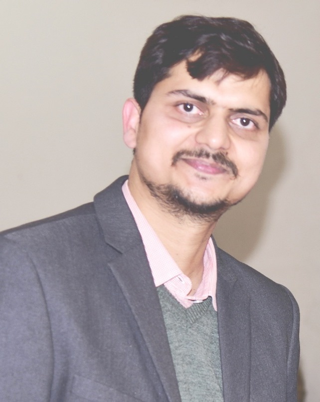
| Dr. Sonam Agrawal
|
| Designation
|
Associate Professor, GIS Cell
|
| Qualification:
|
M.Tech., PhD
|
| Area of Interest:
|
Geoinformatics, WebGIS, Image Processing
|
| Phone No.:
|
+91-532-2271342
|
| Email:
|
sonam@mnnit.ac.in
|
| View Profile
|
|
|
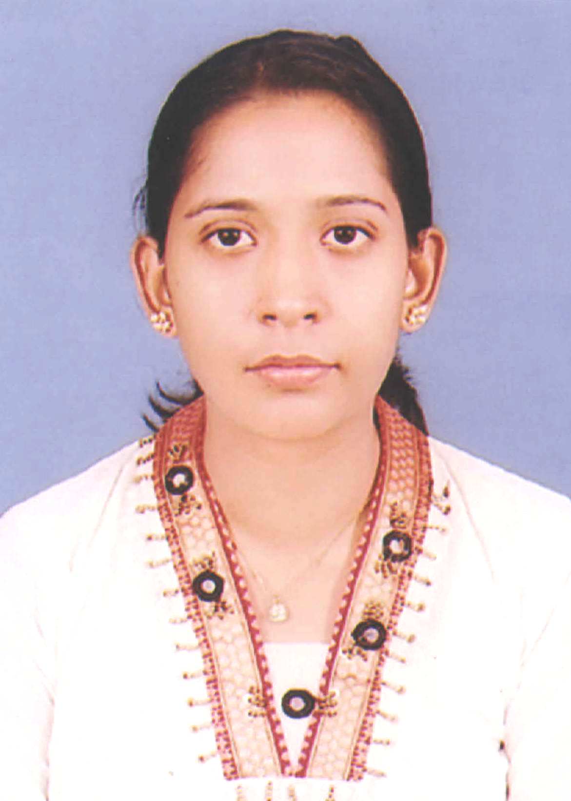
| Dr. Rajitha B
|
| Designation
|
Associate Professor, CSED
|
| Qualification:
|
Ph.D.
|
| Area of Interest:
|
Image Processing, Multimedia Processing and Medical Imaging,Computer Vision,Deep learning.
|
| Phone No.:
|
0532-2271375(O), +91 8052355544
|
| Email:
|
rajitha@mnnit.ac.in
|
| View Profile
|
|

|
Publications
Research excellence in the Geographic Information Systems (GIS) Cell is reflected through a consistent record of high-quality publications in peer-reviewed national and international journals. Faculty members, doctoral scholars, and postgraduate students actively contribute to scholarly literature by publishing research in reputed journals, conference proceedings, book chapters, magazine articles, etc. covering diverse areas of GIS, Remote Sensing, Satellite Geodesy, and Geospatial Analytics. Their research encompasses major geospatial applications, including urban and regional planning, environmental monitoring and management, natural resource management, agriculture and precision farming, disaster management, transportation and network analysis, water resources management, forestry and biodiversity conservation, climate change and vulnerability assessment, land use/land cover mapping, infrastructure and utility management, cadastral and land administration, geospatial artificial intelligence, 3D city modelling, and location-based decision support systems, along with other interdisciplinary domains.
The department's research output also includes book chapters, edited volumes, technical reports, and patents, demonstrating its commitment to innovation, knowledge dissemination, and global research impact. The publications of individual faculty members can be accessed by clicking the hyperlinks provided with their names in the following table.
Research
THRUST AREA OF RESEARCH
-
GIS Technology and its applications: Application of GIS in Transportation Engineering, Supply chain management, Vehicle routing and scheduling, Watershed management, Urban planning and utility management, City modeling, Agent Based System, Geometrical Algebra and Computational Geometry.
-
Satellite Geodesy and its application: Developing advance geodetic frameworks for deformation analysis using Multi Earth Observation dataset, Artificial Intelligence (AI) enabled feature extractions for Disaster management, Geodetic network design and optimization, Advance InSAR for estimating geophysical parameters of interest, Tropospheric monitoring and extreme weather prediction.
-
Satellite Image Processing and its application: Digital Elevation Model (DEM) generation, features extraction and urban sprawl land use mapping using high resolution satellite images fused with airborne LiDAR data; Microwave Engineering and location based services.
-
LiDAR and AI-Based Geospatial Intelligence: Technologies, Processing and Applications: Airborne, Terrestrial, and Mobile LiDAR mapping for high-precision topographic surveying, urban and 3D city mapping, utilities, transportation, railways, and tunneling; advanced LiDAR point-cloud processing including registration, filtering, classification, segmentation, feature extraction, 3D reconstruction, and quality assessment. AI and deep learning-based point-cloud processing for semantic/instance segmentation, object detection, recognition, and automated feature extraction. Development of Mobile LiDAR Systems (MLS) with sensor calibration, integration, synchronization, trajectory estimation, and GNSS/INS integration, including MMS simulation and GPS/GNSS-INS solutions. Applications of LiDAR and AI-driven geospatial technologies in forestry, agriculture, disaster management, environmental monitoring, smart cities, digital twins, infrastructure asset management, autonomous systems, and cultural heritage documentation.
-
Web GIS and its application: Open Geospatial Consortium Services, Open Source GIS, Service Oriented Architecture, Spatial Data Infrastructure, Spatial Decision Support System and Cloud Computing.
Laboratories
1. GIS AND REMOTE SENSING LABORATORY
The followings are the major software and instruments available in the laboratory:
| Sl. No. | Name of Instruments |
|---|
| 1 | ArcGIS Software (University Labkit) |
| 2 | ERDAS Imagine software (Academic licenses) |
| 3 | Handheld DGPS with inbuilt camera |
| 4 | Robotic Total Station with accessories |
| 5 | Geodetic quality GNSS receivers with accessories |
| 6 | Motorised Total Station with complete accessories |
| 7 | FARO Focus3D X 330, a high-speed 3D laser scanner with the hardware accessories and software solutions. |
| 8 | Open source software for geospatial data processing and applications |
| 9 | IBM Blade server |
| 10 | Continuously Operating GNSS Reference Station |
| 11 | 15KVA UPS |
2. GEODESY LABORATORY
Following are the major software and instruments available in the laboratory:
| Sl. No. | Name of Instruments |
|---|
| 1 | GNSS Receiver Kit |
| 2 | Geospatial data processing software with network based licenses |
| 3 | Digital level |
Projects
External Research Projects Ongoing
| S. No. | Name of Research Project | Duration | Funding Agency | Amount sanctioned (Rs. Lacs) | Principal Investigator(s) |
| 1 |
Regional Center for Geodesy (RCG) at MNNIT Allahabad
https://mnnit.ac.in/rcg-mnnit/Home.html |
2022-27 |
DST |
~146 |
Dr. Ramji Dwivedi (PI) |
| 2 |
Monitoring & Investigations on lightning phenomena and its associated processes using lightning detection systems (LDS) at Collaborating Institutes |
2022-27 |
NICES, NRSC, ISRO |
5.00 |
Dr. Ramji Dwivedi (PI) |
| 3 |
Landslide monitoring, strain mapping and landslide forecasting using ALOS (L-band SAR) acquisitions |
2022-25 |
JAXA, Japan |
ALOS-2 Data support |
Dr. Ramji Dwivedi (PI) |
| 4 |
GANANA: India-EU initiative for Scientific High-Performance Computing |
2025-28 |
MeiTY, GOI |
~123 |
Dr. Ramji Dwivedi (PI, MNNITA) |
| 5 |
Crustal deformation analysis in the tectonically active regions of NER using SAR and GNSS data |
2025-28 |
ISRO |
~39.50 |
Dr. Ramji Dwivedi (Co-PI) |
| 6 |
Multi-Model-Geodetic Approach Investigating Coastal Land Subsidence Effects to Sea Level Rise |
2025-28 |
under ISRO NISARUP mission |
26.78 |
Dr. Ramji Dwivedi (Co-PI) |
| 7 |
India-European Union (EU) Consortium Research Project: SUSTENANCE |
2021-26 |
DST – India, European Commission |
~1500 (DST contribution) |
Dr. Manohar Yadav (PI, MNNITA) |
| 8 |
Indian Standards for Mobile LiDAR Surveying and Mapping |
2025 -2027 |
DST |
56.57 |
Dr. Manohar Yadav (PI) |
| 9 |
Multi-sensor-multi-platform LiDAR systems integrated with a camera and artificial intelligence for sustainable forest management and urban tree inventories |
2024-2027 |
UPCST |
13.86 |
Dr. Manohar Yadav (PI) |
Research Projects Completed
| S. No. | Name of Research Project | Duration | Funding Agency | Amount sanctioned (Rs. Lacs) | Principal Investigator(s) |
| 1 |
Multi-Temporal Interferometric SAR (MT-InSAR) studies for near real time landslide monitoring |
2018-22 |
NRSC, ISRO |
45.43 |
Dr. Ramji Dwivedi (PI) |
| 2 |
Landslide inventory preparation using Multi- temporal SAR |
2018-20 |
NRDMS, DST |
20.44 |
Dr. Ramji Dwivedi (PI) |
| 3 |
Multi-sensor approach for landslide monitoring (Jointly with IIT Kanpur) |
|
NRDMS, DST |
36.66 |
Dr. Ramji Dwivedi (Co-PI) |
| 4 |
Airborne LiDAR data quality assessment |
2025-2026 |
BIS |
9.89 |
Dr. Manohar Yadav (PI) |


